
A short update on how the Weather is looking for our departure mid-January 2020 for the Caribbean.
[youtube]https://youtu.be/Qwo69wC3kls[/youtube]
1. What's your strategy for dealing with storm fronts... is eastbound travel different than westbound?
2. Is 1 week before departure too soon to look at weather forecasts? Pros/cons?
3. What tools do you use to analyze weather more than say 3 days out?
4. On a long trip, do you avoid booking lodging in advance?
Thoughts, questions, and suggestions? I'd love to hear from you.
Thanks for your insight and enjoy the video!
Wayne, the GeezerGeek Pilot
Do we need a Plan B already!? Weather Analysis for Flying the Caribbean...
Moderators: Rick, Lance Murray
-
waynemcc999

- 5 Diamonds Member

- Posts: 568
- Joined: Sun Jun 08, 2014 3:38 pm
- First Name: Wayne
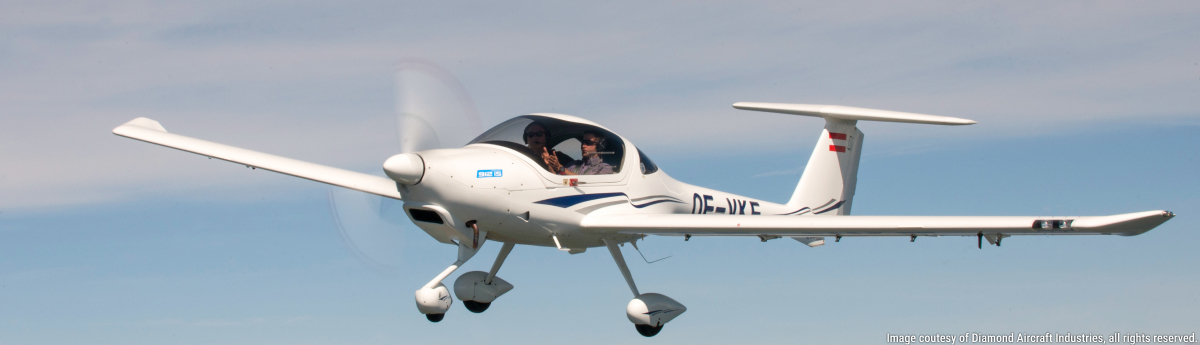
- Aircraft Type: DA40
- Aircraft Registration: N211WP
- Airports: KSBA
- Has thanked: 1517 times
- Been thanked: 411 times
Do we need a Plan B already!? Weather Analysis for Flying the Caribbean...
Wayne McClelland
PPL/IR, 2008 Diamond Star DA40-XLS 40.922, KSBA
Photo logs of PilotsNPaws | Flying Doctors | Angel Flight | YouTube @GeezerGeekPilot
PPL/IR, 2008 Diamond Star DA40-XLS 40.922, KSBA
Photo logs of PilotsNPaws | Flying Doctors | Angel Flight | YouTube @GeezerGeekPilot
-
Boatguy

- 5 Diamonds Member
- Posts: 1866
- Joined: Mon Jan 22, 2018 4:48 am
- First Name: Russ
- Aircraft Type: DA62
- Aircraft Registration: N962M
- Airports: KSTS
- Has thanked: 1366 times
- Been thanked: 1196 times
Re: Do we need a Plan B already!? Weather Analysis for Flying the Caribbean...
1) First, I think you have two different environments to consider as others have also suggested. #1 is getting across the U.S., #2, is moving through the Caribbean. There are many people here with more experience and better advice than me about #1.
With regard to #2, here's my experience at SL. The prevailing "trade" winds are from the E/NE. Lows rolling off the continental US push back on the trades and create a temporary flow from roughly NW to SE. So when moving "down island" to the SE, the strategy is to wait for a low and then ride it. Much better than hammering into a headwind for 18hrs.
Heading "up island" to the NW, the strategy is to avoid the lows and ride the trades.
This is all a little different in an airplane where the wind direction is more of a nuisance than a supreme ruler (sailboats basically cannot travel into wind from 10o'clock to 2o'clock), and true wind from 9-3 is not very pleasant for extended periods. A plane with a crosswind losses a little GS towards the destination, but is only noticeable by looking at the panel.
2) The forecasts are pretty good for 5 days out, less so for 5-10 days out.
3) Windy, which you already use, gives you access to the main three forecast models on the planet. NAM is good for the first 3 days, the European model (EMCWF) for 4-10. GFS is a laggard, but is another model to consider. The European model is quite good and should be factored into the NAM forecast for 1-3 days.
That said, convective activity will frequently kick up in the afternoon in the tropics and is much more important in a plane than on a boat. Like mountain flying, on the ground by noon is a good guideline. The days are long, depart at 6am if you need to log a lot of hours.
4) On a sailboat we say the most dangerous thing is (not the boom...), the calendar! If you expect to be at a certain place, at a specific time, you're setting yourself up for bad decisions.
I'm probably the least experienced pilot on this forum, but this is my experience at SL in the tropics.
-
waynemcc999
- 5 Diamonds Member
- Posts: 568
- Joined: Sun Jun 08, 2014 3:38 pm
- First Name: Wayne
- Aircraft Type: DA40
- Aircraft Registration: N211WP
- Airports: KSBA
- Has thanked: 1517 times
- Been thanked: 411 times
Re: Do we need a Plan B already!? Weather Analysis for Flying the Caribbean...
Russ, you are awesome on this stuff!
Curiosity question... since the trade winds are from the ENE, how come the Leeward Islands (e.g. BVI, Nevis) are on the Windward side, and the opposite for the Windward Islands (St. Vincent, Trinidad)??
Do you find EMCWF or GFS better than the other for the Caribbean? I usually watch both a number of days out, and hope they converge.
We're planning to fly mostly in the mornings, as the inter-island hops are pretty short. Afternoons will be needed for the longer days... e.g. T&C to BVI, Nevis to Exumas.
We intend to be relaxed and flexible when it comes to our day to day schedule... weather wins out.
Many thanks,
Wayne
Wayne McClelland
PPL/IR, 2008 Diamond Star DA40-XLS 40.922, KSBA
Photo logs of PilotsNPaws | Flying Doctors | Angel Flight | YouTube @GeezerGeekPilot
PPL/IR, 2008 Diamond Star DA40-XLS 40.922, KSBA
Photo logs of PilotsNPaws | Flying Doctors | Angel Flight | YouTube @GeezerGeekPilot
-
Boatguy
- 5 Diamonds Member
- Posts: 1866
- Joined: Mon Jan 22, 2018 4:48 am
- First Name: Russ
- Aircraft Type: DA62
- Aircraft Registration: N962M
- Airports: KSTS
- Has thanked: 1366 times
- Been thanked: 1196 times
Re: Do we need a Plan B already!? Weather Analysis for Flying the Caribbean...
Thank you, but there are thousands of people out there on the water at any point in time with the same experience. It's sort of a parallel universe of people on the water.
The big weather picture in the northern hemisphere is a clockwise circle from the equator to the Arctic and back. So draw one from the equator, up the east coast of the US, across Greenland, Iceland, UK, and back down to the equator, then parallel to the equator and past the "windward" islands. At any point in time it's a function of the location of the North Atlantic (or Pacific) high. If it shifts north, the winds are more NE, when it shifts south the winds are more SE. So while I said E/NE, I should probably have said E/SE, sort of depending on your latitude and the latitude of the high. Set Windy to show winds and zoom out to show the entire Pacific or Atlantic (or S. Atlantic or S. Pacific) and you'll readily see the dominant synoptic weather pattern. Additionally, the "windward" islands are slightly east of the leeward islands and thus receive the wind first.
I don't have an opinion about EMCWF vs GFS. On the boat I only had the GFS because that was what NOAA distributed in an arcane low bit rate format and I could gain access to it via sat phone. I've more lately found the EMCWF to be better in general, but they've been upgrading the GFS as well. In any case, they are forecasts, not guarantees. Lows can still still roll through further south and I've spent days on the hook in a protected anchorage while a low passed through even in winter.
But even in the usual good winter weather, convective activity in the afternoon is always a possibility. As a sailor it meant the decks would get a nice fresh water wash. As a pilot I'd be much more defensive and really get down by noon as it can blow up very quickly. Most of those airports are situated where local terrain can be a big influence and there aren't many alternates. Mornings are always gorgeously clear and beautiful.
You'll have a great trip and we'll be jealous while it's raining and cold in Northern California!
-
waynemcc999
- 5 Diamonds Member
- Posts: 568
- Joined: Sun Jun 08, 2014 3:38 pm
- First Name: Wayne
- Aircraft Type: DA40
- Aircraft Registration: N211WP
- Airports: KSBA
- Has thanked: 1517 times
- Been thanked: 411 times
Re: Do we need a Plan B already!? Weather Analysis for Flying the Caribbean...
Now, that clockwise explanation on windward/leeward makes sense!
We’ll also make more effort to get down by noon.
Cool stuff! Thx.
Wayne
We’ll also make more effort to get down by noon.
Cool stuff! Thx.
Wayne
Wayne McClelland
PPL/IR, 2008 Diamond Star DA40-XLS 40.922, KSBA
Photo logs of PilotsNPaws | Flying Doctors | Angel Flight | YouTube @GeezerGeekPilot
PPL/IR, 2008 Diamond Star DA40-XLS 40.922, KSBA
Photo logs of PilotsNPaws | Flying Doctors | Angel Flight | YouTube @GeezerGeekPilot
-
CFIDave

- 5 Diamonds Member
- Posts: 2682
- Joined: Wed Nov 07, 2012 3:40 pm
- First Name: Dave
- Aircraft Type: OTHER
- Aircraft Registration: N333GX
- Airports: KJYO Leesburg VA
- Has thanked: 234 times
- Been thanked: 1480 times
Re: Do we need a Plan B already!? Weather Analysis for Flying the Caribbean...
1. What's your strategy for dealing with storm fronts... is eastbound travel different than westbound?
Flying westbound has the advantage that you can always land to wait for a storm front to pass harmlessly over you. While paying attention to weather fronts is important, in the wintertime flying a DA40 without deice means you also need to be more attentive to cloud cover and freezing levels, forcing you to adjust your course north/south. e.g., last March while ferrying Russ' new DA40NG from the Canada factory to CA, we were forced to fly all the way to the Mexican border to avoid icy clouds. And don't forget to consider mountain waves in the winter where winds aloft can easily exceed 20 knots perpendicular to mountain ridges.
2. Is 1 week before departure too soon to look at weather forecasts? Pros/cons?
I find that I can drive myself crazy checking changing weather forecasts that far out -- my mental health is improved by waiting until about 3-4 days before departure.
3. What tools do you use to analyze weather more than say 3 days out?
I'm also a big proponent of using Windy.com (or the Windy app); it's one of the few tools with free access to the superior (compared to US GFS) European forecast model.
4. On a long trip, do you avoid booking lodging in advance?
This is always a tough call. If you can cancel at the last minute without financial penalties, then go ahead and book in advance. But as you know that's not always possible; we've always booked our rooms in advance when flying to Bahamas resorts. If you decide to risk waiting to find lodging after you've arrived, at least try and determine beforehand if there are any conventions, meetings, or events planned by other groups that may book all the rooms at your destination.
Epic Aircraft E1000 GX
Former DA40XLS, DA42-VI, and DA62 owner
ATP, CFI, CFI-I, MEI
Former DA40XLS, DA42-VI, and DA62 owner
ATP, CFI, CFI-I, MEI
-
waynemcc999
- 5 Diamonds Member
- Posts: 568
- Joined: Sun Jun 08, 2014 3:38 pm
- First Name: Wayne
- Aircraft Type: DA40
- Aircraft Registration: N211WP
- Airports: KSBA
- Has thanked: 1517 times
- Been thanked: 411 times
Re: Do we need a Plan B already!? Weather Analysis for Flying the Caribbean...
Dave, thanks for the thorough and thoughtful response. I'd say we're very much in sync on all these points.
We'll see how this Caribbean trip plays out... I'm expecting we'll have many adjustments to make .
Thanks again, and have a great year flying!
Wayne
We'll see how this Caribbean trip plays out... I'm expecting we'll have many adjustments to make
Thanks again, and have a great year flying!
Wayne
Wayne McClelland
PPL/IR, 2008 Diamond Star DA40-XLS 40.922, KSBA
Photo logs of PilotsNPaws | Flying Doctors | Angel Flight | YouTube @GeezerGeekPilot
PPL/IR, 2008 Diamond Star DA40-XLS 40.922, KSBA
Photo logs of PilotsNPaws | Flying Doctors | Angel Flight | YouTube @GeezerGeekPilot
-
AndrewM

- 4 Diamonds Member

- Posts: 239
- Joined: Sun Nov 20, 2016 2:05 pm
- First Name: Andrew
- Aircraft Type: DA40
- Aircraft Registration: N897KC
- Airports:
- Has thanked: 73 times
- Been thanked: 75 times
Re: Do we need a Plan B already!? Weather Analysis for Flying the Caribbean...
OK... since this thread has involved aviation and boating (in the Bahamas), I hope someone will have the answer to my question. I will be sailing from Nassau to the Exuma Islands on February 16th, and apparently there will likely be a GPS black out that day due to military exercises somewhere in the region. The question is, if I have a iPad with cellular, which means it has GPS -- IF GPS is out, assuming I have a cell signal, will it still give me a fix on my approximate position? For some reason I think I read somewhere this is the case, as the iPad will use cell towers for giving an approx. fix first, and then once GPS locks in the position is more accurate? Appreciate anyone that may have the facts on this one.
-
Steve

- 5 Diamonds Member
- Posts: 1973
- Joined: Thu Aug 12, 2010 1:23 am
- First Name: Steve
- Aircraft Type: DA40
- Aircraft Registration: N432SC
- Airports: 1T7
- Has thanked: 85 times
- Been thanked: 504 times
Re: Do we need a Plan B already!? Weather Analysis for Flying the Caribbean...
How many cell towers are positioned on the sea? If you are relying on island based towers, you should be close enough to determine your position by bearing and range from the island itself...
-
Colin

- 5 Diamonds Member
- Posts: 2006
- Joined: Sat Aug 21, 2010 8:37 pm
- First Name: Colin
- Aircraft Type: DA42
- Aircraft Registration: N972RD
- Airports: KFHR
- Has thanked: 319 times
- Been thanked: 527 times
Re: Do we need a Plan B already!? Weather Analysis for Flying the Caribbean...
No GPS or location signal delivered via the cell network.
Colin Summers, PP Multi-Engine IFR, ~3,000hrs
colin@mightycheese.com * send email rather than PM
http://www.flyingsummers.com
N972RD DA42 G1000 2.0 s/n 42.AC100 (sold!)
N971RD DA40 G1000 s/n 40.508 (traded)
colin@mightycheese.com * send email rather than PM
http://www.flyingsummers.com
N972RD DA42 G1000 2.0 s/n 42.AC100 (sold!)
N971RD DA40 G1000 s/n 40.508 (traded)